The parcel
Walk the parcel.
Drawn from the registered cadastral survey and from the measured topographic survey of October 2024. Anything the owner provides rather than a document is marked as such.
Certificate area
7,000 m²The survey measured 6,999.866 m²Sea frontage
45 mSandy, with reef beyondDepth
≈160 mBeach east to the village roadRear elevation
≈8.6 mAbout a 5% grade, tiered viewsPerimeter wall
345 m300 m at 175 cm, plus the low front wallSurvey pillars
13Registered, on the cadastral surveyAsking price
IDR12.4BIDR 12,356,000,000 ≈ USD 690,000 · Reference value, settled in RupiahPer square meter
IDR1,765,000≈ USD 99 · Beachfront, serviced and zonedShown at 1 USD = IDR 17,908, published Oct 15, 2026, indicative only.
Where a house would go
A 45 by 160 meter rectangle running east from the beach to the village road. Thirteen registered survey pillars, 300 m of stone wall on three sides, and a low wall across the frontage so the view is kept.
Twelve keys of 79 m², each an 8 by 8 m volume with a 5 by 5 m half-level and its own 4 by 3 m plunge pool, scattered between 21 and 156 m along the land so none stands behind another. The main house and a 20 by 5 m pool hold the beach end; 17% of the parcel is built on.
Indicative massing only, drawn over the survey outline. It is not a design, not a permit and not a statement of what may be built. As on any Indonesian coastal parcel the statutory coastal border zone, sempadan pantai, restricts building near the shoreline and should be verified for your own design as part of your due diligence.
Elevation, west to east
true scale · 1:1Drawn at true scale: 8.6 m of rise across 160 m, about one in nineteen. Enough that anything set back sits above what is in front of it, and gentle enough to build on without cut and fill. Taken from the measured topographic survey.
Sunset, all year
The sunset azimuth here swings between 246° in December and 294° in June. The frontage faces 268°, so the sun goes down over the water in front of the land every day of the year.
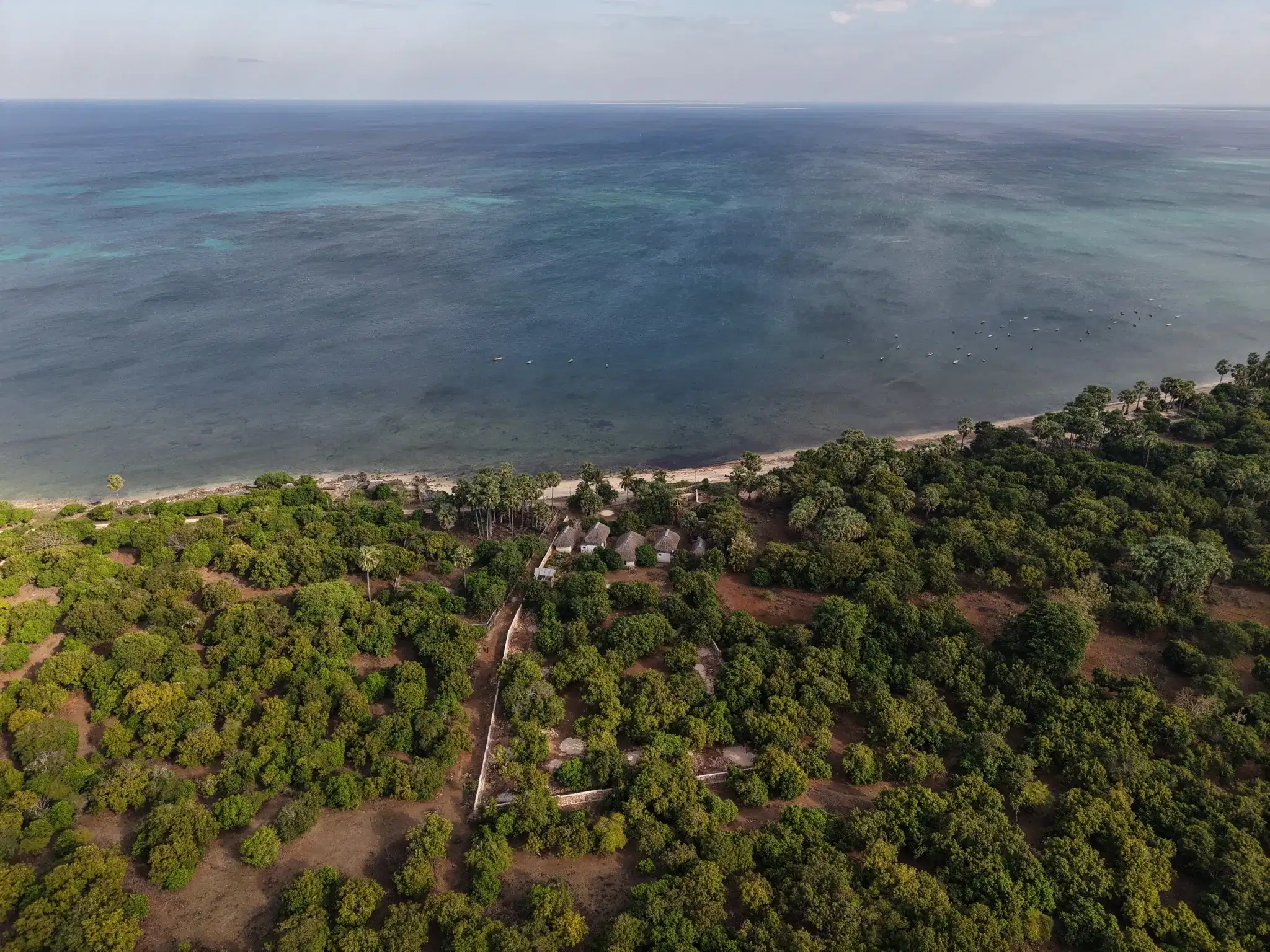 A peaceful early morning in July, from the middle of the parcel.
What is already connected
Four other parcels are for sale on this coast. Two publish a price.
Freehold/HGB beachfront land between Sedeoen, Nemberala and Boa, currently listed. That is the whole set: this coast is not a market with pages of inventory. Every figure below links to the listing it came from, so you can check it rather than take my word.
Listed without a sale price
Asking prices as published on 27 August 2026 and converted to US dollars per square meter at the JISDOR rate that day. Asking prices are not sale prices and they change; follow each link for the current figure. Parcels are listed here when they are Freehold/HGB, on the Sedeoen to Boa coast, and publish a price.
↓ What it costs to buy itSeen enough of the parcel?
Ask about anything: boundaries, the well, what the neighbors are building. Or drop down to the title and the numbers.
What each season is like
Apr to Jun
Coming goodDry, with the easterly winds building. The west coast comes into its own.Jul to Sep
High seasonPeak swell on the reef breaks, and the busiest the area gets.Oct to Nov
Still and hotGlassy mornings. The topographic survey was shot in October.Dec to Mar
Rainy seasonAfternoon rain and green everything. A tide above 2.85 m with a west wind can reach the front wall.