East Nusa Tenggara, Indonesia

Rote Island

Indonesia's last island south, and the one it forgot to develop

Rote sits below Timor, at the bottom of the archipelago. It is dry, low and quiet. No volcano, no traffic, 155,000 people spread across 1,280 km². This page is the island on its own terms, written by the owner of a parcel of Rote land for sale: the rock it stands on, the weather, the people, what the economy runs on, and what living here involves.

1,280km²

Island area

155k

People, BPS projection for 2025

0

Active volcanoes

107islands

In the Rote Ndao archipelago

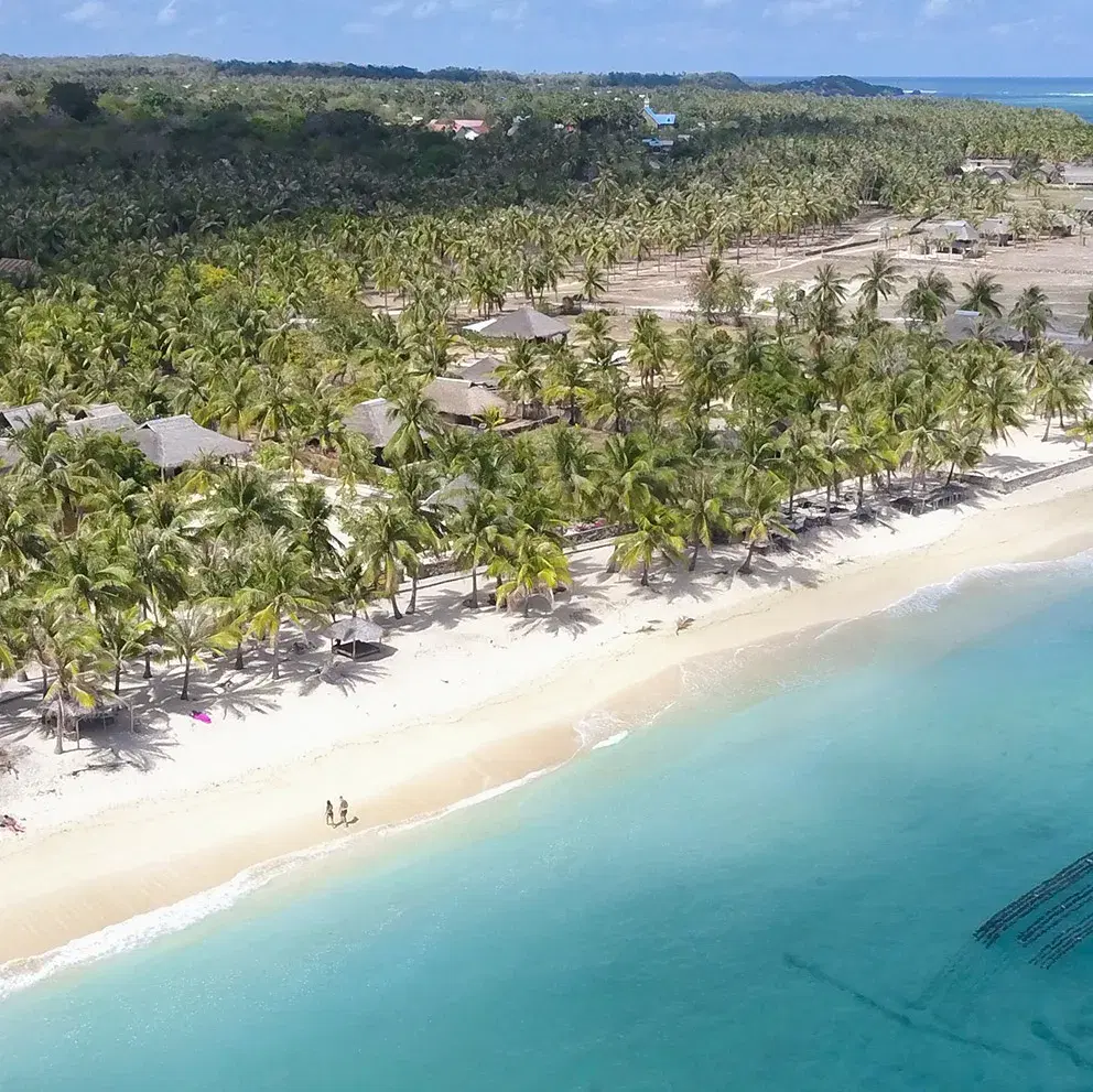
Looking west across the reef from the Rote coastline to the Savu Sea

The ground

An island with no volcano

Bali, Lombok and Flores sit on a volcanic arc. Rote does not sit on it at all. This is the part of the island most visitors never learn, and it changes more than the scenery.

Indonesia's Lesser Sunda islands come in two arcs. Bali, Lombok, Sumbawa and Flores sit on the inner arc, which is volcanic. Rote, Savu and Timor sit on the outer arc, which is not.

Rote is not built from lava. It is uplifted seabed. Its rock is marine sediment from the Permian through the Miocene, pushed above water where the Australian plate meets the Banda arc. The reef terraces you walk on were once underwater.

So there is no volcano here, and no volcanic soil either. That is why the island is savanna rather than rice terrace, and why the water off it runs clear rather than grey.

Rote is also new. Geologists dated its highest coral terrace, 200 m above the sea, at around 200,000 years old, and measured the island rising at roughly 1.5 mm a year. In geological terms it has only just come up for air.

Roosmawati & Harris, Tectonophysics 2009
Aerial view of the shallow reef flat and clear water off the west coast of Rote

Reef flat off the west coast. Uplifted seabed, not lava.

The shape of it

Rote Ndao is not one island but 107, of which 8 are inhabited. Together they hold 1,280.10 km² of land, about 330 km of coastline and 2,376 km² of sea. Ba'a, on the north coast, is the seat.

The Savu Sea lies to the north and west, the Timor Sea to the south. Savu and Sumba are the next islands west.

Low and rolling. The regency's own profile puts the whole of it between sea level and 500 m.

The west coast faces the Savu Sea and the sunset. The reef sits close in, so the water goes turquoise at low tide.

The east side is a maze of inlets and small islands. That is Mulut Seribu, the Thousand Mouths.

Ten districts, 112 villages and 7 urban wards, for a population smaller than a single Denpasar sub-district.

Pemkab Rote Ndao
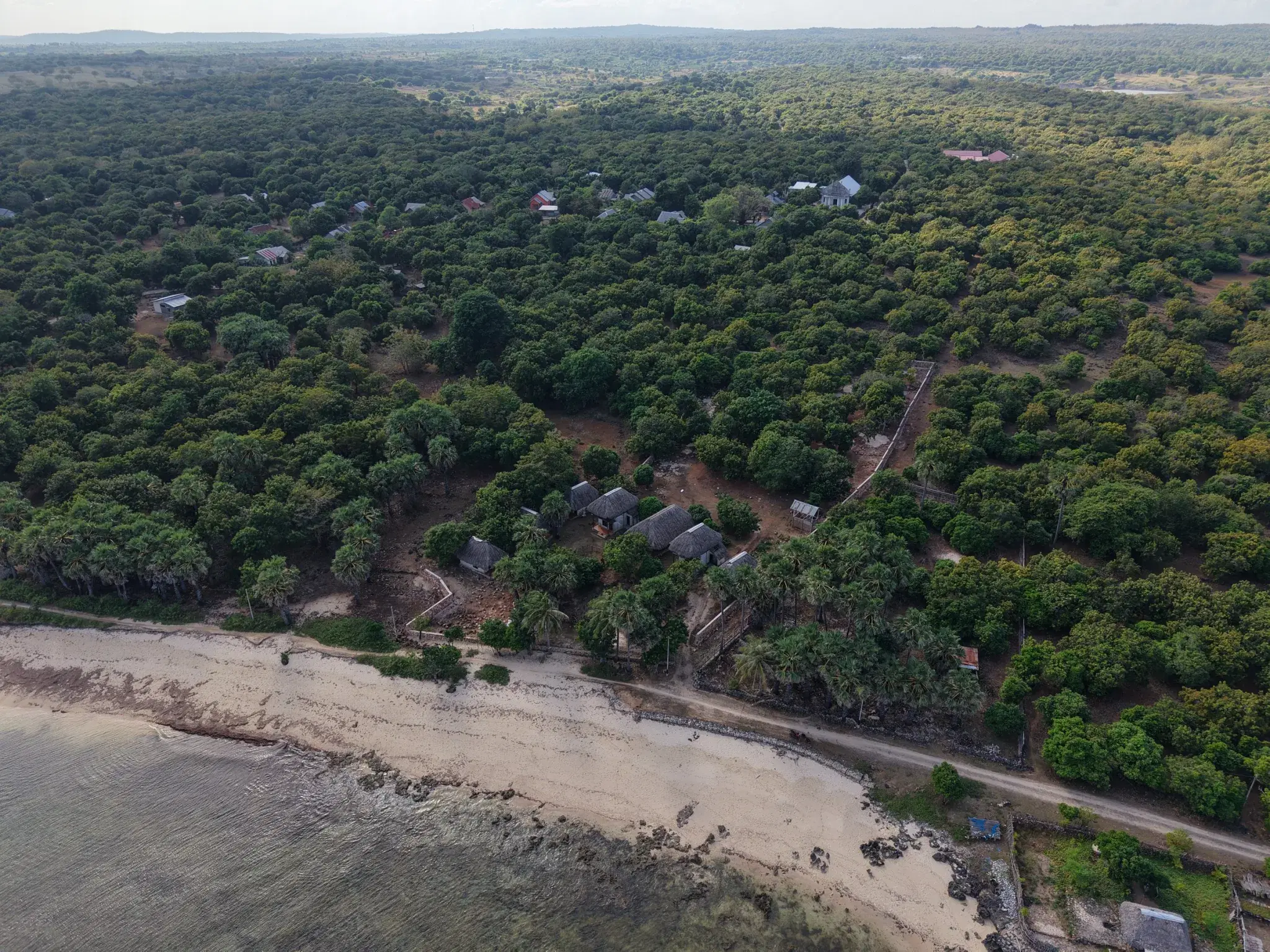
The full parcel from the rear boundary to the shoreline, seen from directly above

Uplifted reef terrace, walled and titled. The ground here has been above water for around 200,000 years.

Climate

Two hundred and fifty days a year without rain

East Nusa Tenggara is the driest corner of Indonesia and Rote sits at the bottom of it. If you have ever waited out a Bali wet season, this is the other kind of island.

Wet, December to March

Rain arrives with the west monsoon and mostly falls in short heavy bursts. The island turns green for a few months.

Dry, April to November

The east monsoon brings steady trade winds and very little rain. Grass goes gold, skies stay open, and the surf season runs.

109 rain days in 2022, concentrated in January and February. For most of the year it simply does not rain.

Temperatures ran from 25.3 °C in July to 28.4 °C in October and November. The wind does the cooling.

The strongest winds came in July, at 8 to 9 knots. Those are the trades that hold the west coast waves open through the surf season.

Water is a dry-season subject here. Wells, tanks and storage matter more than they would in Bali.

BPS Rote Ndao, Regency in Figures

People

155,000 people, and a culture of their own

Rote Ndao is its own regency, and Rotenese identity is distinct from anywhere further west.

152,613

Population, mid-2024

155,342

Projection for 2025

about 121

People per km²

811 per km²

Bali, for comparison

BPS Rote Ndao

The lontar palm

It feeds, roofs and clothes traditional life here. Sap, sugar, thatch, rope, containers. Ask anyone on Rote what the island runs on and this is the first answer.
The sasando

A stringed instrument built from palm leaf and bamboo. It is Rotenese, and it carries the iconography of the whole province.

The ti'i langga

The wide palm-leaf hat, shaped like a sombrero with a spike. The island's most recognisable object.

A Protestant island

Rote is one of the few overwhelmingly Christian places in Indonesia. At mid-2024 the regency recorded about 95.6% Christian, of which 93.7% Protestant and 1.9% Catholic, with 4.4% Muslim. Sunday matters here, church bells carry across the villages, and the calendar of festivals is a Christian one layered over older ancestral practice.

More than one language

Rote is not linguistically one island. Each nusak had its own speech variety, and several are distinct enough to be described separately. Dela, spoken in the west, has about 11,000 native speakers and its own reference grammar, written as a doctoral thesis at the Australian National University in 2021.

ANU Open Research

Nusak, and adat

Until the nineteenth century Rote governed itself as a set of semi-autonomous domains called nusak, each with its own leadership. Customary authority, adat, still carries weight alongside the state.

History, briefly

Settlement came from the Timor region. By the eighteenth century the island was a patchwork of nusak rather than a single kingdom.

Dutch consolidation eroded that autonomy through the nineteenth century but left adat largely intact. Protestant missions from the 1800s produced the Christian majority the island still has.

Rote sat on the route between Java, Bali and Timor, so outside contact is old news here. Tourism is the new part.

The Rote coastline and the inland plain behind it

Economy

Seaweed, salt, fish and cattle

A small, marine, working economy that has just started drawing ministers and a vice-president to the island. Tourism is not yet a line item here, and that is the opportunity written as a statistic.

Seaweed

Eucheuma cottonii is farmed along the shallows and is the headline crop. In May 2026 the Vice-President visited Rote to push modernisation and downstream processing rather than raw export.

Pemkab Rote Ndao

Salt

The Ministry of Marine Affairs and Fisheries has been building a national salt industry centre at Matasio on Rote, and has publicly offered investment opportunities there.

KKP

Fish, corn and cattle

Capture fisheries, maize and livestock carry most households. Add lontar products, which sit somewhere between agriculture and craft.

Pemkab Rote Ndao

Tourism, still small

Surf camps, homestays and a handful of villas around Nemberala and Boa. Real, growing, and a fraction of what the coastline could carry.

Where the money actually comes from

Share of Rote Ndao's economy by sector, from the statistics agency's own accounts for 2023:

Agriculture, forestry and fishing

49.3%

Public administration

13.4%

Education

13.2%

Wholesale and retail

7.5%

Construction

4.7%

Information and communication

4.2%

Real estate

1.0%

Accommodation and food service

0.19%

That last line is not a typo. Hotels, homestays and restaurants together make up under a fifth of one percent of the island's economy. Rote is not a tourism economy yet.

BPS Rote Ndao, GRDP by industry 2019 to 2023

Scale, in one number

GRDP per capita is around IDR 27.9 million, growing roughly 4.39% a year over five years. Small in absolute terms, and compounding steadily. That is what an early regional economy looks like from the inside.

Databoks, from BPS

Nature

Reef, wind and empty coast

The water is the draw, the space around it is the luxury, and both are protected by a national park rather than by luck.

The west coast breaks

T-Land at Nemberala has been on the surf map since the early 1980s. Boa, Do'o and Suckies are all within a short run of it. The season is April to October.

Mulut Seribu

A labyrinth of inlets and islets on the east side, formally designated an international tourism destination by the province of NTT. About two hours by road from Ba'a.

ANTARA Kupang

Inside a 3.35 million hectare marine park

The sea around Rote is inside the Savu Sea Marine National Park, which at 3,355,352 hectares is the largest protected marine area anywhere in the Coral Triangle. It was created by ministerial decree, reaches across ten regencies and is run from Kupang. What it exists to protect includes the reef itself, the seagrass beds, the mangrove, the beaches turtles nest on, and the whales that pass through here on migration.

YKAN

Reef and marine life

Fringing reef along most of the west coast, shallow and close in. Mantas and dugongs are cited in tourism material for the wider area.

And the honest wildlife note

Saltwater crocodiles live across East Nusa Tenggara, concentrated in the estuaries and mangrove of West Timor. Across the whole province, a survey running from 2006 to late 2016 counted 86 attacks. One of those was on Rote, at Pantai Baru on the far eastern side. The reef beaches of the west coast are not the habitat they use. Worth knowing, and worth keeping in proportion.

Sideleau, NTT crocodile survey

Savanna and lontar

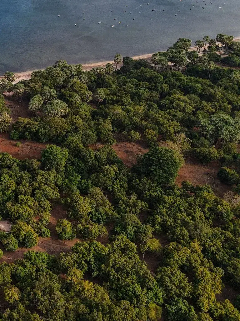
Open grassland with palms, not jungle. Long sightlines, hard light, and a landscape that looks nothing like the rest of Indonesia.

Boats moored off the reef on the west coast of Rote

Surf

The reason anyone came here first

Rote has been on the surf map since the 1980s, and the west coast still holds one of the longest lefts in Indonesia. Operators put the season anywhere between March and November; the core of it is mid-year, when the south-east trades blow offshore along this coast and south-west groundswell arrives from the Roaring Forties.

On the ground

A morning on the west coast

Filmed along the beach at the end of the dry season, which is what most of the year looks like here: hard light, offshore wind, and nobody else on the sand.

T-Land

Besialu reef, off Nemberala

Shape

Left, reef

Level

Intermediate to advanced

Access

Paddle, or a minute by boat

The headline wave, and the reason the island has a name in surfing. A long left over flat reef, quoted at 600 to 1,200 feet of ride and anywhere from 2 to 15 feet of face. Breaks on all tides and goes fat only on a small swell at high water.

Nemberala Bombie

Beside the Besialu reef

Shape

A-frame, reef

Level

Advanced

Access

Paddle

Glass or the lightest easterly, a south swell, and water on the lower side. When it lines up you get a barrel and then a long wall to drive off, and once the swell steps up it stops being fun for most people.

The Spit

200 m south of The Point

Shape

Left and right, reef

Level

Experienced on the left

Access

Paddle

A gap in the reef about fifty metres across, best on an easterly and plenty of water. The left is the one worth travelling for. The right is gentler but the bottom comes up fast, so it pays to know where you are sitting.

Squillers

Inside reef, Nemberala beach

Shape

Left and right, inside reef

Level

Beginner to intermediate

Access

Paddle from the beach

The soft one, on the inside between the beach and the Bommie. Mid to high tide, easterly wind, and a longboard. This is where people who are not ready for T-Land actually enjoy themselves.

Saku Namor

Suckies, Sucky Mamas, Peanuts

Shape

Right, reef

Level

Advanced

Access

About ten minutes by boat, 4 km north

Line up on the church. There are two take-offs, one further out than the other, and both stand up hollow enough to matter. Go early, before the trades arrive. Avoid it at low water, and take a boat, because the track in is not worth the bike.

Oe Mau

Boa, Bo'a

Shape

Right, reef

Level

Advanced at low, easier at high

Access

6 km south, ten minutes by road

A right-hander of the kind Indonesia is known for, and it seldom pushes past eight feet. At four or five it hands you hollow sections and then a long wall to work. Any tide will do; a northerly or an early start does better.

Do'o

Off Do'o island

Shape

Right, reef

Level

Experienced

Access

Ten to twenty minutes by boat

One of the waves off the uninhabited islands sitting in front of this stretch of coast. Uncrowded in a way that takes some explaining to anyone who learned to surf in Bali.

Bibi Usu

North of Nemberala

Shape

Reef

Level

Advanced

Access

By boat

A wet-season wave that only wakes up on cyclone swell. Small by Rote standards and far heavier than its size suggests, and quick with it. The difficulty is the calendar: that time of year, boats and flights are cancelled often enough that you cannot really plan a trip around it.

Fanny Rock

Beside Bibi Usu

Shape

Reef and rock

Level

Experienced only

Access

By boat

Everything at once: rock, thin water over the reef, a current that runs, and waves that break hard. Nobody here dresses it up. If you are wondering whether you are ready for it, you are not.

Ndana

Dana Island

Shape

Left and right, reef

Level

Intermediate to advanced

Access

About 30 minutes by boat, south-west

The southernmost island in Indonesia: 14 km², nobody living on it, half a day out of Nemberala. Both a left and a right run into the channel, and around the north-west side there is another left that only works when the sea is calm. Most people admit the sail home is half the appeal.

1 Palm

In front of 81 Palms, Sedeoen

Shape

Reef

Level

Beginner

Access

Paddle from the beach

The one to learn on. It sits right in front of the 81 Palms resort and works best on a lower mid tide. It is fussy about water though: come at dead low or high and it simply is not there.

Dickson's Right

Boat charter lists

Shape

Right

Level

Still secret

Access

By boat from Nemberala

Another of the boat waves off this stretch of coast. The name gives away the direction and nothing else. Ask at Nemberala the evening before.

Petrol Bombs

Named alongside Do'o

Shape

Still secret

Level

Still secret

Access

By boat

Turns up on one surf guide's list of Rote breaks with no description attached. Included here because leaving it out would be tidier and less honest.

The peaks at T-Land

T-Land is not one takeoff. It is a run of peaks along the same reef, and on the right swell they join up.

The Point

The top of the reef and the shallowest of them. Steep drop, fast and hollow off the take-off. Some of the older operators call it The Peak.

The Pyramid

The one most people surf. Sits in the middle of the reef and on a good day runs about 300 metres down the line into Bananas.

The Mountain

Takes the most swell volume of the three, so it is where the wave stands up biggest and throws its barrel sections.

Bananas

The end section, where the reef bends. Hollow and awkward, best on a mid to high tide, and the reward for making the whole wall.

There are more, and people are not in a hurry to name them. Nemberala's surfing festival runs each September and is promoted by the regency itself.

Detail

Three things you will not read in a brochure

Small facts, all of them checkable, that say more about Rote than any description of the beaches.

There is a Harvard book about this island's palm trees

In 1977 the anthropologist James J. Fox published Harvest of the Palm, a study of how Rote and Savu built durable societies on lontar sap while their neighbours went hungry in dry years. Tapping the palm gave Rotenese households a food supply that did not depend on rain. It is still the clearest explanation of why this island looks and behaves the way it does.

Harvest of the Palm, 1977

A turtle is named after the island, and only lives here

Chelodina mccordi, the Rote Island snake-necked turtle, was described in 1994 and is found nowhere else on earth. Collection for the international pet trade was so intense that it is now presumed extinct in the wild, and survives in captive breeding colonies. Conservation groups including WCS Indonesia are working on reintroduction.

WCS Indonesia

The east coast gets called the Raja Ampat of the south

Mulut Seribu, the Thousand Mouths, is a maze of green inlets and limestone islets on the far side of Rote. The government's own portal describes it in exactly those terms. It sits about two hours by road from Ba'a, and almost nobody outside NTT has heard of it.

indonesia.go.id

Living here

What daily life involves

Simpler than you expect, and with Starlink, no longer remote in any way that matters for work.

PowerPLN grid along the developed coast. Connections exist; capacity varies by parcel, so check the specific supply rather than the street.
WaterWells and storage. Rain is seasonal, so tanks are normal rather than optional.
InternetStarlink has changed this completely. Remote work from the west coast is now ordinary.
HealthOne regional hospital at Ba'a, plus community health centres. Kupang is two hours away by ferry, Bali under two hours from there by air.
Shops and foodMarkets at Ba'a and Busalangga. Fish, rice, vegetables, fuel. Anything specific comes from Kupang.
Getting aroundA motorbike or a pickup. Roads are sealed on the main routes and rough off them.
LanguageBahasa Indonesia everywhere, Rotenese at home. English around the surf spots.
PaceAdministration runs slower than Bali. Plan around it and nothing about it is a problem.
SchoolThe Imagine Learning Centre at Nemberala: a non-profit international school for pre-school and primary ages, English and Bahasa Indonesia, local and international children in the same classrooms, in brand-new purpose-built buildings.

Who lives here

Start with who was here first. Nemberala, Sedeoen and Boa are villages, and the families in them have fished this reef, tapped the lontar and farmed the flats for generations. Anyone who moves here moves into their neighbourhood. The ones who do it well arrive as guests and become neighbours: they learn some Bahasa, turn up to the wedding and the church feast, hire and buy locally, and do not try to remake the place in their own image. Rote makes that easy, because people here are generous with newcomers who show up properly.

The foreign residents are few, and they have a particular shape. A good number built something in Bali first, a business, a practice, a name, in the years when that was still possible, and came to Rote once they no longer needed to be anywhere in particular. They chose this coast with their eyes open, and they were in a position to choose.

It makes for a quiet crowd, and an open one. Newcomers are taken in fast, by Rotenese families as much as by other foreigners: a fisherman's family, a couple long retired and a twenty-year-old on a surf season end up at the same table, and the table is usually someone's house rather than a beach club. The French here call it bienveillant, and there is no better English word for it: people look out for each other. Live on Rote for a month and you cannot cross the west coast without running into a friend. Nobody is here to be seen, which is much of why the people who are here stay.

The community now has a school of its own. The Imagine Learning Centre, a non-profit at Nemberala started on land given by a local family, teaches pre-school and primary children in English and Bahasa Indonesia, Rotenese and international side by side, in brand-new purpose-built buildings. For a family weighing a move, it is the detail that changes the answer.

Imagine Learning Centre, Rote

Safer coast

Coastal hazards, side by side with Bali, Lombok, Andalusia and Sicily

Three hazards, three official models, one measure each, read at the point named under every figure: the wave height each probabilistic tsunami model gives for a 2,500-year event, the ground shaking the Global Earthquake Model's world map gives on rock, and whether there is a volcano. The same yardstick for every coast, so the comparison holds.

Rote, IDwest coast
Tsunamiwave height for a 2,500-year event2 to 6 mBanda Arc coastHorspool et al. 2014
Earthquakeground shaking with a 10% chance in 50 years0.22 gOn rock, at NemberalaGEM Global Seismic Hazard Map
Active volcano
NoneOuter, non-volcanic arc
Bali, IDsouth coast
Tsunamiwave height for a 2,500-year event25 to 30 mSunda Arc coastHorspool et al. 2014
Earthquakeground shaking with a 10% chance in 50 years0.27 gOn rock, at KutaGEM Global Seismic Hazard Map
Active volcano
Agung, BaturInner volcanic arc
Lombok, IDsouth coast
Tsunamiwave height for a 2,500-year event25 to 30 mSunda Arc coastHorspool et al. 2014
Earthquakeground shaking with a 10% chance in 50 years0.30 gOn rock, at Kuta MandalikaGEM Global Seismic Hazard Map
Active volcano
RinjaniInner volcanic arc
Andalusia, ESAtlantic coast
Tsunamiwave height for a 2,500-year eventAbove 3 mGulf of CádizNEAMTHM18, Basili et al. 2021
Earthquakeground shaking with a 10% chance in 50 years0.10 gOn rock, at CádizGEM Global Seismic Hazard Map
Active volcano
None
Sicily, ITeast coast
Tsunamiwave height for a 2,500-year eventUnder 5 mCataniaNEAMTHM18, Basili et al. 2021
Earthquakeground shaking with a 10% chance in 50 years0.32 gOn rock, at CataniaGEM Global Seismic Hazard Map
Active volcano
EtnaEurope's most active volcano
Same measure for every coastRote, IDwest coastBali, IDsouth coastLombok, IDsouth coastAndalusia, ESAtlantic coastSicily, ITeast coast
Tsunamiwave height for a 2,500-year event2 to 6 mBanda Arc coastHorspool et al. 201425 to 30 mSunda Arc coastHorspool et al. 201425 to 30 mSunda Arc coastHorspool et al. 2014Above 3 mGulf of CádizNEAMTHM18, Basili et al. 2021Under 5 mCataniaNEAMTHM18, Basili et al. 2021
Earthquakeground shaking with a 10% chance in 50 years0.22 gOn rock, at NemberalaGEM Global Seismic Hazard Map0.27 gOn rock, at KutaGEM Global Seismic Hazard Map0.30 gOn rock, at Kuta MandalikaGEM Global Seismic Hazard Map0.10 gOn rock, at CádizGEM Global Seismic Hazard Map0.32 gOn rock, at CataniaGEM Global Seismic Hazard Map
Active volcanoNoneOuter, non-volcanic arcAgung, BaturInner volcanic arcRinjaniInner volcanic arcNoneEtnaEurope's most active volcano

Tsunami: Rote's coast faces the Banda Arc, where Indonesia's national assessment puts a 2,500-year wave at 2 to 6 m. Bali's and Lombok's south coasts face the Sunda Arc megathrust: 25 to 30 m for the same event, and the annual probability of a wave above 0.5 m there is put at more than 10%, naming Bali, Lombok, Flores and Sumba. Rote and Timor are not on that list. Europe's model, built the same way, gives the Gulf of Cádiz above 3 m and eastern Sicily under 5 m: the same range as Rote. BNPB's own risk index says the same thing in its own units: Rote Ndao 8.23, Medium, against 13.67 to 17.68 on Bali's coasts and 15.36 on Lombok's south coast, all High.

Earthquake: on the Global Earthquake Model's world map, Rote's west coast sits at 0.22 g, below Bali's south coast (0.27 g), Lombok's south coast (0.30 g) and eastern Sicily (0.32 g), and above Andalusia's Atlantic coast (0.10 g). Rote sits where the Australian plate meets the Banda Arc, so it is not earthquake-free; it is rated below the coasts it is usually compared with.

Volcano: Rote has none. It sits on the outer, non-volcanic arc, and BNPB does not list it in its eruption table. Bali has Agung and Batur, Lombok has Rinjani, and Sicily has Etna, Europe's most active volcano, above Catania. Andalusia has none either.

The 1977 Sumba earthquake, the largest outer-rise event ever recorded in Indonesia at Mw 8.3, sent a tsunami into Sumba, Sumbawa, Lombok and Bali, and as far as north-west Australia. Rote does not appear in the run-up record for it.

None of this is a guarantee, and any building here should meet Indonesian building code as it would anywhere in the country. Tsunami figures are the maximum wave heights each official probabilistic model gives for a 2,500-year return period: Horspool et al. 2014 for Indonesia, NEAMTHM18 (Basili et al. 2021) for Europe. Earthquake figures are peak ground acceleration on rock with a 10% chance of exceedance in 50 years, read off the Global Earthquake Model's map at Nemberala, Kuta (Bali), Kuta Mandalika (Lombok), Cádiz and Catania. Volcano is the presence of an active volcano on the island or region.

Questions people ask

Rote Island, answered briefly

Where is Rote Island?

At the southern tip of Indonesia, off the western end of Timor in East Nusa Tenggara province, between the Savu Sea to the north and the Timor Sea to the south. It is the country's southernmost inhabited island.

Does Rote Island have a volcano?

No. Rote sits on the outer, non-volcanic arc of the Lesser Sunda islands, unlike Bali, Lombok and Flores on the inner volcanic arc. Its rock is uplifted marine sediment, and its highest coral terrace, 200 m above sea level, is about 200,000 years old. Rote Ndao does not appear in BNPB's volcanic eruption risk table.

Is Rote Island at risk of tsunami?

Less than Bali or Lombok, on the official numbers. BNPB's 2023 disaster risk index scores Rote Ndao 8.23 for tsunami, classed Medium. Bali's highest regency, Jembrana, scores 17.68 and its tourist south coast 12 to 16 (Badung 13.67, Klungkung 15.90), all High; Lombok's highest, Lombok Tengah with Kuta and Mandalika, scores 15.36, High. The national tsunami hazard assessment places the highest hazard on the Sunda Arc, which Bali and Lombok sit on and Rote does not.

What is the population of Rote Ndao?

152,613 at mid-2024 and 155,342 projected for 2025 by the statistics agency, across 1,280 km² of land: about 121 people per km², against roughly 811 in Bali.

What is the weather like on Rote Island?

Dry for most of the year. The wet season runs December to March; the dry season, April to November, brings steady south-east trade winds. Rote Ndao recorded 109 rain days in 2022 and monthly temperatures between 25.3 °C and 28.4 °C.

When is the surf season on Rote?

Roughly May to October, when south-west groundswell from the Southern Ocean meets offshore south-east trade winds on the west coast. Some operators quote March to November.

What are the main surf breaks on Rote Island?

T-Land at Nemberala, a long left over the Besialu reef, is the famous one. Boa (Oe Mau) is the classic right. Others include the Nemberala Bombie, The Spit, Squillers for beginners, Saku Namor (Suckies), Do'o, Bibi Usu, Fanny Rock, Ndana island and 1 Palm at Sedeoen.

What religion is practised on Rote Island?

Rote is overwhelmingly Christian: about 95.6% at mid-2024, of which 93.7% Protestant and 1.9% Catholic, with around 4.4% Muslim.

What does the Rote Ndao economy depend on?

Agriculture and fishing, which made up 49.3% of the regency's economy in 2023: seaweed farming, capture fisheries, maize, cattle and lontar palm products. A national salt industry centre is being developed at Matasio. Tourism was 0.19%.

Is Rote Island inside a marine park?

Yes. The waters around Rote are part of the Savu Sea Marine National Park, 3,355,352 hectares, the largest marine protected area in the Coral Triangle, established by ministerial decree and managed from Kupang.

Are there crocodiles on Rote Island?

Saltwater crocodiles occur across East Nusa Tenggara, mostly in the estuaries and mangroves of West Timor. A survey covering 2006 to 2016 recorded 86 attacks in the whole province, one of them on Rote at Pantai Baru on the east coast. The reef beaches of the west coast are not crocodile habitat.

Is it easy to make friends on Rote Island?

Unusually so, starting with the Rotenese, whose villages these are and who are generous with newcomers who show up properly. The west coast community is small and mixed: Rotenese and foreign residents, families, single people and every age share the same handful of tables, and newcomers are taken in within weeks rather than years. Many of the foreign residents settled here after years in Bali, and the community now has an international school at Nemberala where local and international children learn together.

Is there an international school on Rote Island?

Yes. The Imagine Learning Centre at Nemberala, on the west coast, is a non-profit international school for pre-school and primary ages, teaching in English and Bahasa Indonesia with international and local children together, in brand-new purpose-built buildings.

Why people stay

A coastline with almost nobody on it, water you can see the bottom of, a two-hour connection to Bali, no volcano under your feet, and an island that kept its own culture rather than borrowing one. It is not a resort. For the people who end up here, that is exactly the point.

If you want to buy here

How buying on Rote actually works

The three legal routes open to foreigners, what a transaction costs, and what to check before you sign.

Read the guide

The parcel for sale

Neala, 7,000 m² of beachfront

Registered HGB, zoning approved, walled, powered and connected. Sold directly by the owner.

See the land
WhatsAppDirect with the ownerOwner